Welikanda was garrisoned when I got off the bus. Appropriate for what turned out to be a garrison town. Maybe more even than Ampara. A blue rope cordoned alighting passengers to one side of the market area. To the left, some continued to a shed where they were checked and then joined some kind of political rally. There were guns everywhere. I mean every ten feet. Was the president in town? (Actually turns out he was!) I thought it was his voice I recognized, and the cadence of his speech, something I've heard on television and slow enough that even I can pick up a few words.

Past the immediate point of departure there were still uniformed soldiers with guns every few feet. It was as unexpected as it was disconcerting. I had passed no fewer than three military camps as we approached town and in back of the market I accidentally started down the road to a fourth.
Asking one of the gun-bearing soldiers the way to the Welikanda-Sinhapura Road, which I planned to follow to the so-called Magul Pokuna tank, my goal for the day, he pointed south. Actually I'd passed the sign for Sinhapura about a km back and should have paid closer attention. I wonder how real the name Sinhapura (Lion - or Sinhala -city is).

The road to Sinhapura was pleasant enough. Very pleasant in fact. The large acacia trees shading the road on both sides provided a comfortable if lonely path to follow. They also provided a hint. Planning went into this road. Might it be connected to the Mahaveli scheme? The Mahaveli River is just two towns west of Welikanda and it's in that vicinity that I've planned some walks to small tanks for when Janet gets back. Not able to wait, I started on one of my walks today.
I don't know much about the Mahaveli scheme except that it was a major post-colonial endeavor here to open much new land for irrigation as well as create a major hydropower facility along with a huge western-style dam. The contemporary tank that I ended up at last week was my first glimpse at auxiliary irrigation construction, at least if my hunch is right that that was connected with Mahaveli. I also remember reading somewhere that Mahaveli also exacerbated Sinhala-Tamil tensions in the '70s by resettling ethic Sinhala Sri Lankans in traditionally Tamil regions and distributing newly opened lands in a way that many Tamils felt was unfair. In a conversation with Tamil friends this evening who fled Sri Lanka in 1983 after their homes were burnt that issue was corroborated.
So, unbeknownst to me today, I ended up in another borderland. I've seen borderlands in Vavuniya and Ampara and closer to home (here) in Kattankudy. The wonderful peaceful graceful Sri Lanka we'd like to imagine is a tense place of conflicting ethnic, linguistic, and political entities. The easygoing rough and tumble of cosmopolitan Colombo belies the ominous murk of what's happening here in the East. My feelings about it this trip are worse than last time we were here.
In fact the military garrisons were only emblematic of a larger and I think, more sinister story. It's a story that's played out at the hyper local level as well as on the larger district scale. It's about borders, ethnicity, hegemony, ownership, and in part, religion. And from what I've been seeing it isn't a pretty picture.
Putting issues aside for a moment I want to describe the method I've developed for planning out my walks here. I take several screen shots of google maps at the closest detail possible. I hate the little icons that I can't get rid of- they take up so much of the screen. And I don't have room on my iPhone for google earth. It's a bunch of pesty workarounds but I guess that epitomizes my problems. They are so "first world."

So reading between the lines on my screen shot is a bit of guesswork and luck. Where does the road come in? Where is the crucial turn in the road? The cut off? The dead end? Figuring these things out in blazing heat when you don't have a water bottle (hate the extra hand it takes) is part of the fun. Proud to say I know enough Sinhala akuru (alphabet) that I was able to take the correct turn toward Magul Pokuna on an unpaved road, something that google maps provide no clue about. Does the look of this sign provide another clue about the nature of this village? Hint: you don't see signs like this near ancient villages.

So the long walk along the dirt road, decidedly unshaded but not without loveliness of its own. I especially like the sounds from inside the houses as people prepare for the afternoon meal. Also remarkable that not one person has looked up or greeted me on the road, as much of a strangeness as I must appear. Who are these people I wonder, and what have they experienced out here in "Magul Pokuna?

The dirt road has curved like the map suggested it would. At one point there is a ponselya (Buddhist temple) that has none of the look of places I've seen before. No bo tree I can see. No dagoba I can see. Is this the religious institution of a garrison village?

One. Two. Three possible turns to the left but I haven't counted them as I should have. I go past the third but my google map has shown me that the village road should end here. It doesn't. But the pavement does. Enough of a clue. I turn back and follow the road that dips just past the ponselya. Soon the Magul Pokuna tank is in sight.

My guess is that this tank is not ancient. Electrical pylons (seen elsewhere I guess but here they're too much in evidence) provide a backdrop. There is a woman bathing in the spillway that somehow doesn't have the flavor of a spillway, which is usually accompanied by gorgeous natural pools and eddies and the reflections of trees (though this is not necessarily the case in the East). The bund is shaped kind of randomly-more an engineered straight line than a sculpted curve. Water hyacinths abound but few trees. The one sluice (again! Only one sluice!) juts into the water in a way I haven't seen.


I see the main road not far off and I'm more than happy to follow this unpaved road to get to it. I'm burning with the sun and more significantly, I'm burning with the thought of where I've been and what I've witnessed. To any eye it looks like a rural landscape. To my intuitive approach this place looks like a war zone in slow motion. It is a hateful thing to perceive. So are the bleak resettlement villages, half inhabited of that much, that line the road.


At the main road a bus passes me almost immediately. Another one that I flag down passes, lets a woman off, and drives off as I run toward it. This part of the road is treeless. It is 1:30 PM. I walk west toward Welikanda but I don't want to trudge all the way there in the sun. It's a mile or two west and I'll be facing the sun all the way. Besides. Buses are frequent.
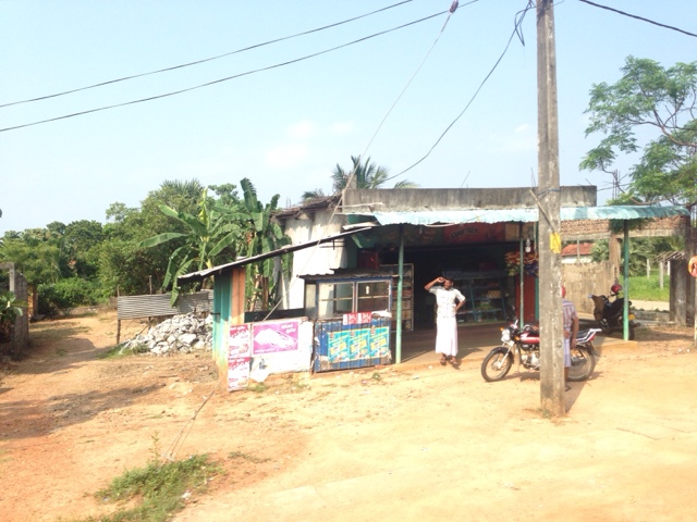
Those frequent buses don't show and I'm lured to the kade across the road. They sell me a water bottle for ten rupees above the printed cost. Their karma. The old man points to my pocket and says "pen." I take it out and he grabs and says "thank you." I don't like where I am or the people I'm with.
I catch a bus barely hanging off the back stairs it's so crowded but that ends soon. I get a window seat and I witness the expanse of scrub forest, some of it planted with eucalyptus, that separates the Tamil east from Sinhala Welikanda. Some poor looking Muslim communities between act as a kind of buffer, along with the military garrisons.
My reward for studying intangibles in the landscape has been rewarded with the tangible evidence for ongoing ethnic conflict. I am sunburnt and dehydrated and a bit saddened. I think of Thavarajah and his laser focus on the truth. I think of my new friends here and how they left in 1983. I think of my people and what they experienced in 1938.
Anyway I'm thankful to get back to the oasis of Batticaloa.

Insightful and invigorating.You need plenty of water on such trips.Keep exploring and the conundrum of remote tank associated villages will unravel.
ReplyDelete